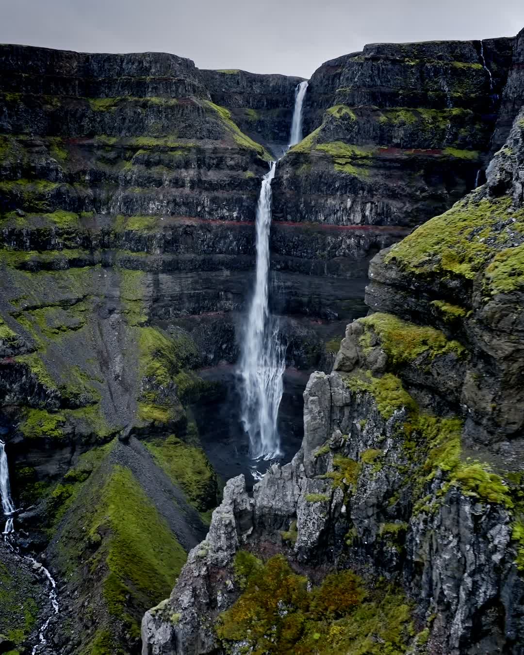
Waterfall


Strútsfoss
Hidden gem waterfall
Category
Est. Duration
1-2h
Also
Hike
Message from
Ronald Soethje
Activity level
Age requirement
All ages
Seasonality
Summer
Get more specific info on spot
Nearby local secrets
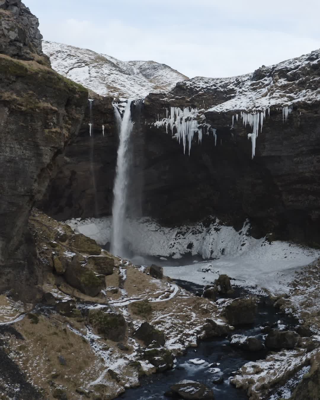
Waterfall
Kvernufoss
Hidden gem with unique perspective
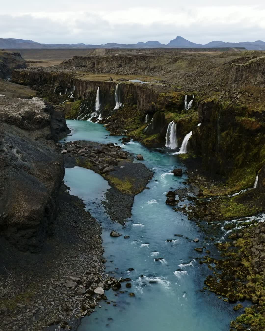
Photospot
Sigöldugljufur
Hidden oasis in Icelandic Highlands

Waterfall
Tungnaárfellsfoss
Serene Icelandic wilderness waterfall

Photospot
Búðakirkja
Charming wooden church
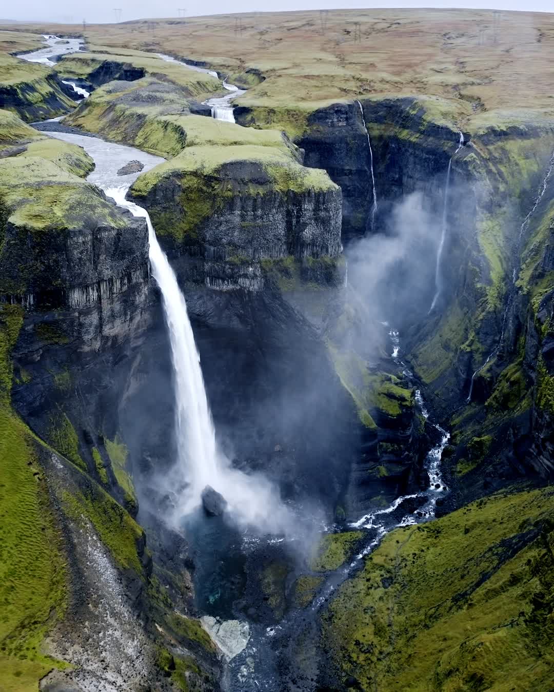
Waterfall
Háifoss
Stunning Icelandic waterfall off beaten path

Photospot
Kirkjufell Mountain
Iconic Icelandic mountain with history
Creators are the next-gen travel advisors and operators
Planning your trip through social media? Now, easily access travel advice and tours created by the world’s best travel content creators