


 Hike
Hike Tours
Tours
The highest and longest guided aerial tramway in the Canadian Rockies🏔️🚡
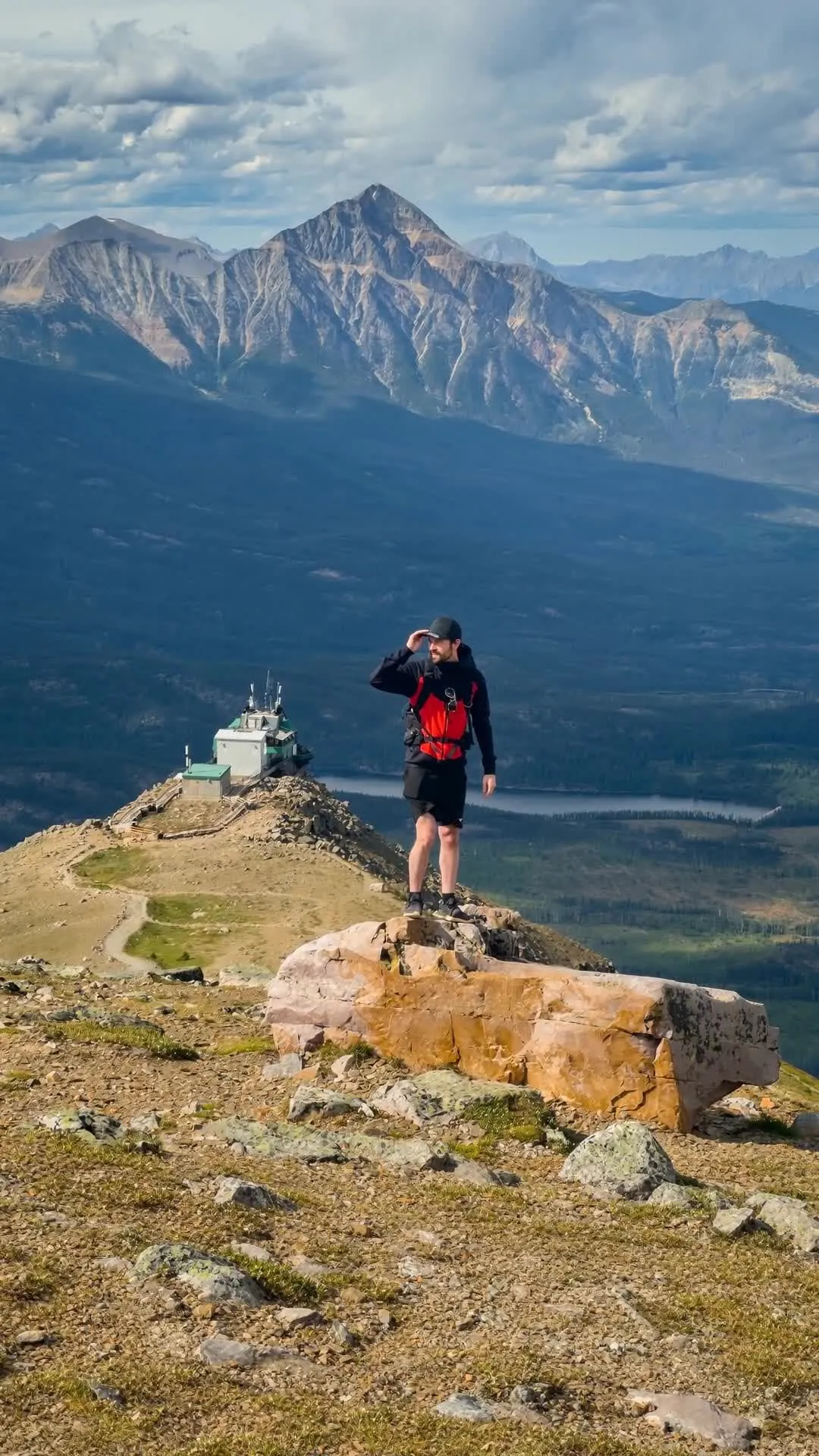
Rising over 1000 metres above the valley floor, the Jasper SkyTram takes you up the slopes of Whistlers Mountain in 7.5 minutes, dropping you off at the upper station at an elevation of 2263 metres. From the top, you get amazing panorama views spanning six mountain ranges, the Athabasca River valley, and the entire Jasper townsite below.
On a clear day, you can even spot the glacier-capped peak of Mount Robson in the distance, which is over 100 km away (as the crow flies), and is the highest peak in the Canadian Rockies - standing at a height of 3954 metres tall!
You can chill out and soak in the views at the upper station, or grab lunch with a view. However, you can actually continue further up the mountain on foot (trail details below). A short and steep alpine trail leads from the upper tram station, right up to the true 2464 metre summit of Whistlers Peak. It’s one of the easiest ways in the region to reach a genuine high-alpine summit without a full day grind.
ㅤ
🏔️ TRAIL STATS & DETAILS
(if hiking from upper station to the peak)
Best Seasons: Summer
Distance: 3.9 km (to peak and back)
Trail Type: Out & Back
Elevation Gain: 279 m
Max Elevation (altitude): 2464 m
Bike Friendly?: No
Dog Friendly?: Yes - The Jasper SkyTram is pet-friendly! While you should book your 'human' tickets online in advance to be safe, the pet fee is paid separately (at the lower station ticket window upon arrival - which is $6 CAD last I checked)
Trailhead Toilets?: Yes
Parking: Free
Parks Pass: Parks Canada Pass Required
🚗Directions to gondola base: Google Maps
🗺️AllTrails route: Whistlers Mountain via SkyTram (route from the top of the SkyTram Summit to Whistlers Peak - suggestion only)
ㅤ
✨ TRAIL HIGHLIGHTS - Why you should go
SkyTram Ride
Summit Café & Treeline Restaurant
360-Degree Views of 6 Mountain Ranges
Possible wildlife sightings of Hoary Marmots, Bighorn Sheep, and Ptarmigans
Distant views of Mount Robson (highest peak in the Rockies, standing 3954 metres tall)
ㅤ
🏕️ CAMPING OPTIONS
Campsite At Gondola?: No, but very close!
Close Camp Recommendation: Whistlers Campground
ㅤ
🚡 JASPER SKYTRAM RIDE
The Jasper SkyTram operates seasonally from late spring to October. Roundtrip tickets include a fully guided SkyTram ride with an attendant sharing local history, geology, and wildlife facts along the way. Time slots sell out quickly during peak summer months, so booking online in advance is highly recommended to not miss out. If you want to book the SkyTram ride, you can check availability and pricing here: Jasper SkyTram Roundtrip Ticket
7.5 minute ride up, over 1000 metres of elevation with an onboard guide.
Access to the upper viewing decks, accessible boardwalks, and interpretive displays.
Access to the Summit Café, Treeline Restaurant and high-alpine summit trail network.
ㅤ
🎉 SUMMIT EVENTS & ENTERTAINMENT
The SkyTram hosts specialized high-altitude experiences throughout the season, including 'Star Sessions' astronomy nights during Jasper's Dark Sky Festival. As well as early morning SkyTram rides, and early season snowshoeing experiences at the upper station when there is snow on the ridge.
ㅤ
🍽️ SUMMIT CAFÉ & TREELINE RESTAURANT
Dining at 2263 metres high! Inside the upper station, the restaurant has panoramic, floor to ceiling windows looking over the Athabasca River and surrounding mountain ranges. It's a great spot to warm up with a hot coffee or enjoy some food after hiking up to Whistlers Peak!
ㅤ
✅ TIPS FROM DEV, LINKS & SAFETY
Altitude: You are over 2200 metres up here! Take it slow on the incline to Whistlers Peak if you feel lightheaded.
Trail Conditions: The boardwalks at the upper station are big and easily accessible. However, the trail to Whistlers Peak is a loose dirt and gravel alpine track.
Bundle Up: Expect temperatures at the upper station to be roughly 10°C cooler than down at the valley floor, with wind exposure along the ridge. Always bring a jacket, toque, or shell layer - even in July.
See Parks Canada for the latest National Park trail conditions.
Parks Pass: Parks Canada Pass Required


